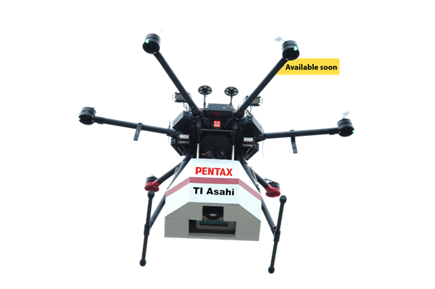
UAV Laser Survey System
Precise aerial imaging system
- Integrated lightweight laser scanner
- High resolution camera with 36.4 million pixels
- GNSS sensor with high speed rate GNSS sensor which determines the position of UAV at 25 Hz
- Measuring position and attitude with high accuracy using GPS/IMU system
- Control flight with the accuracy of cm order
- Laser measurement distance up to ground level of 250m
- Excellent performance at a low price
Click here for data sheet- UAV-Leaflet-EN.pdf
Description
Precise aerial imaging system
- Integrated lightweight laser scanner
- High resolution camera with 36.4 million pixels
- GNSS sensor with high speed rate GNSS sensor which determines the position of UAV at 25 Hz
- Measuring position and attitude with high accuracy using GPS/IMU system
- Control flight with the accuracy of cm order
- Laser measurement distance up to ground level of 250m
- Excellent performance at a low price
Click here for data sheet- UAV-Leaflet-EN.pdf


